
Hoofprints on the Cypress Hills

Updated:
September 6, 2016By Tania Millen, BSc, MJ
Trail riding across endless tall-grass Canadian prairie in summer sunshine, possibly through a herd of bison, was a long-term dream that drew me like an arrow to Saskatchewan. But it took the misery of a snowy six-month-long northern winter in Terrace, BC, to turn the dream into reality.
I’ve been doing horse pack trips in Western Canada every summer since 2010 and initially planned a pack trip through Grasslands National Park in southwest Saskatchewan. However, water is scarce in this region. And testing the horse-friendliness of re-introduced (loose) bison while riding a green-broke four-year-old thoroughbred-cross sounded unwise. Instead, I planned day-rides in the East and West Blocks of Grasslands National Park and the western portion of Cypress Hills Interprovincial Park, which included tying up at the hitching rail of Fort Walsh National Historic Site – the original homestead of the Northwest Mounted Police.

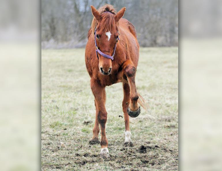
Robbie, the author’s four-year-old thoroughbred-cross gelding, enjoys a break in the East Block Badlands of Grasslands National Park. The area is the richest resource for dinosaur fossils in Canada. Photo: Tania Millen
In late May I was off, driving east for two days with my gelding, Robbie, in the trailer and my dog on the front seat. I crossed both the Rocky Mountain Continental Divide, which separates rivers flowing west from those flowing east, and the other continental divide which splits rivers flowing south to the Gulf of Mexico from rivers flowing north to Hudson’s Bay and the Arctic Ocean. We also chased a thunderstorm, travelled over 900 km in one day, scorched through pancake-flat Brooks, Alberta, got the requisite flat tire, and saw pronghorn antelope. Our destination was The Crossing Resort, a private horse-friendly camping operation located on the boundary of Grasslands National Park.
Having settled in at The Crossing, our first day-ride was out the back field of the property, down the road and up onto 70 Mile Butte on the north side of the Frenchman River valley. Locals say that it’s named “70 Mile” either because you can see for 70 miles from the top of the butte, or because it’s located 70 miles west of the historic Northwest Mounted Police Wood Mountain Post. Either way, as the highest point around, it provides a great view and was important to First Nations and settlers of the region.

Our first day-ride from The Crossing Resort, a private campground on the boundary of Grasslands National Park. They say you can see 70 miles down the Frenchman River valley from 70 Mile Butte. Photo: Tania Millen
This first ride was an eye-opener. Grasslands National Park is one of North America’s largest and least disturbed tracts of northern mixed-grass prairie, and Canada’s only national prairie park. It is a dark sky preserve (an area kept free of artificial light pollution to promote astronomy), and is known for its silence. Unlike better known national parks, there are sporadic visitors, minimal albeit sufficient visitor facilities, and only the sounds of the wind and native birds. The spring flowers were small but bright, and the soil was slick after rain due to its high clay content. The weather typically included an early sun followed by thunderstorms in the afternoon and spectacular sunsets. There are over 12,000 ancient teepee rings within the park.The nearby village of Val Marie includes an informative Parks Canada visitor centre and a well-appointed bookstore/internet café operated by the Friends of Grasslands Society. The former brick schoolhouse, convent (now a country inn) and iconic wooden grain elevator buildings are still standing. Large ranches and farms dominate the area, which in the late 1800s was known as the endpoint for the Chisholm Trail, a cattle track from Texas.
The following day, due to slick road conditions, I didn’t haul my horse into Belza Campground located down in the Frenchman River valley of the West Block. Belza is a horse-friendly campsite complete with open-top pipe stalls, water, a manure bin, port-a-potty, and free-roaming bison. It’s also permissible to turn hobbled horses out with the bison. Belza Campground also provides access to three day-rides which head southwest through the Broken Hills, northeast through coulees to a tree (yes, one tree!), or west to 70 Mile Butte. None of these are trails, just suggested routes which require basic route-finding skills.
Having checked out the West Block, I headed over to the East Block of the park for a day-ride. The Village of Wood Mountain serves the East Block of the park. However, as it’s 180 km between the East and West Blocks on a typical Saskatchewan “highway” - a rough two-lane paved strip with no shoulder - I didn’t have time to explore the Village or see the former Northwest Mounted Police post.

The East Block of Grasslands National Park features the Killdeer Badlands which were untouched by glaciation. It is here in 1874 that the first find of dinosaur remains in Western Canada was recorded. Photo: Tania Millen
The East Block is known for its badland topography, which is typical of southern Alberta but unusual in Saskatchewan. My day-ride destination was Zahursky Point, which is named after the family that homesteaded there in 1912, and is an internationally-significant area of intense erosion. It’s one of the best locations in North America to see the Cretaceous-Tertiary boundary – a time 65.5 million years ago when an asteroid struck earth and dinosaurs died out.
The ride itself was easy – a 10 km route along the rim and down to the bottom of the dramatically eroded Rock Creek valley. Due to persistent overnight rain there was high potential for quicksand in the valley bottom, so I stayed along the rim enjoying the views, sky, and silence.
Before the afternoon thunderstorms hit, I ventured down the access road to the McGowan visitor centre and horse-friendly Rock Creek campground. This campground has similar amenities to Belza but without the bison. It’s also surrounded by a large unfenced grassy grazing area where horses may be turned out with hobbles. Additionally, there’s a 16 km out-and-return trail from Rock Creek campground, which crosses Rock Creek (at a marked crossing to avoid quicksand) then continues to a viewpoint. However, with more rain in the forecast, it was time to turn the trailer around and head west to Cypress Hills.

Established in 1875 in the heart of the Cypress Hills, Fort Walsh was the most important fort for the North West Mounted Police (NWMP) during the early years in the West. The Fort was the headquarters of the NWMP from 1878 to 1882, and from 1942 to 1968 served as a remount ranch where horses were bred for the RCMP. The iconic image of the RCMP mounted on black horses was born at Fort Walsh, and many of the horses in the RCMP Musical Ride today trace their ancestry to horses raised at the Fort.
The Cypress Hills are situated on the Alberta/Saskatchewan boundary within Cypress Hills Interprovincial Park. The highest point between the Atlantic Ocean and the Rocky Mountains, these hills are ecologically and culturally important, and have their own weather systems. The park is very horse-friendly, with a large equestrian campground on Battle Creek. However, to avoid driving the park’s rain-slick gravel roads, I opted to camp at Historic Reesor Ranch, which bounds the north side of the park. The ranch has been owned and operated by the Reesor family for over 100 years, and they provide excellent facilities for campers who choose to bring their own horse (and dog).
My first day-ride was up to the tops of the hills to get my bearings. I felt very comfortable in the misty weather and lodgepole pine forest, and was thrilled to come across a portion of the Trans-Canada Trail, some wild clematis and rare orchids.

Robbie putting hoofprints on the highest point between the Atlantic Ocean and Rocky Mountains. Photo: Tania Millen
The following day, under sunny skies, I rode southeast on a 30 km return trip to Fort Walsh National Historic Site. The route went up to the tops, down a single-track forested trail, along Battle Creek, past the equestrian campground and through deciduous forest to the Fort.
The equestrian campsite on Battle Creek was quite substantial, with pole corrals, an extensive number of tie stalls, a large group paddock, manure pit, and access to the creek for water. Camping amenities included picnic tables, outhouses, fire rings, and potable water. The site appeared well used and I chatted with several friendly riders before continuing on to the Fort.
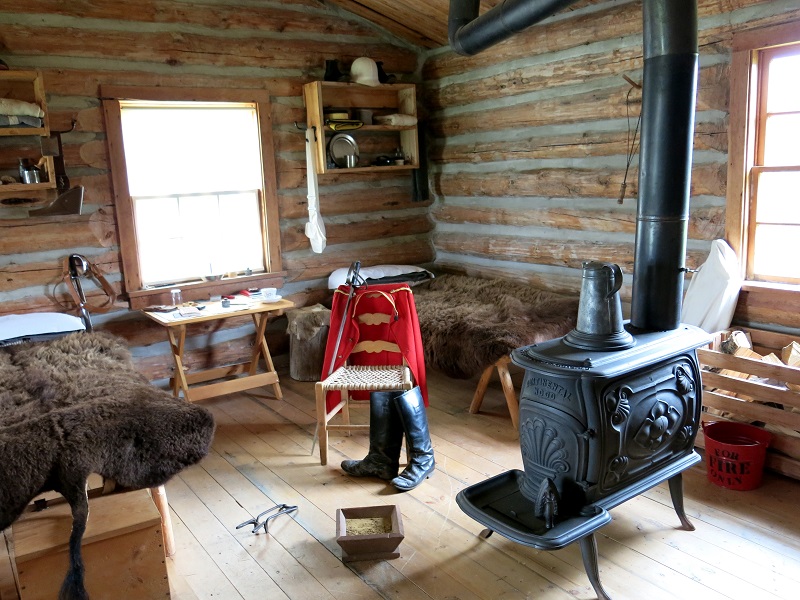
A typical Northwest Mounted Police bedroom at Fort Walsh, complete with buffalo hide bed cover. Photo: Tania Millen
Riding up to the Fort felt like stepping back in time - a feeling enhanced by staff who greeted us in period costumes, and who were perfectly happy to have a horse in their midst. The welcoming atmosphere makes sense, as from 1878 to 1882 the fort was the headquarters of the North West Mounted Police and from 1942 to 1968 it was used to breed horses for the RCMP. But the importance of the fort in Canadian history is its role in policing Canada’s western frontier: it was built due to the Cypress Hills massacre of 1873; it was where Canada’s Indian policy was implemented; and it was where the Lakota and Sitting Bull fled after the Battle of the Little Bighorn in Montana in June 1876, commonly referred to as Custer’s Last Stand. Considering this history, riding into the fort and tying up to the hitching rail certainly felt like the right way to visit.
As expected, entry into the Fort wasn’t free, but the staff were impressed when I produced a National Parks pass rather than paying the entry fee. (The pass is designed to hang on a rear view mirror but I wasn’t too sure where to hang it on my horse – his ear??) During a private tour by costumed staff, I garnered an appreciation of the challenges that the mounted police faced when they first formed. I then tried – unsuccessfully – to convince the costumed RCMP officer to hop on my horse to pose for photos; however, he happily posed on foot while having his pockets nosed for treats.
The ride back through the hills to Reeser Ranch allowed time for reflection on the trip. Southwest Saskatchewan is an overlooked and unique part of Canada which is spectacular in different ways than the mountains of the west. It’s also surprisingly horse-friendly, and has a variety of operations that enthusiastically embrace horseback tourists. So although it’s a long way to drive and surprisingly, sunshine isn’t guaranteed, the big skies, storms, silence, prairie landscape, and many horse-friendly places that I didn’t have time to visit will draw me back again.
Tania Millen is an avid backcountry rider, sometimes writer, and occasional environmental consultant who may be found in Terrace, BC, when not out exploring with her horses.
Check out more Holidays on Horseback.
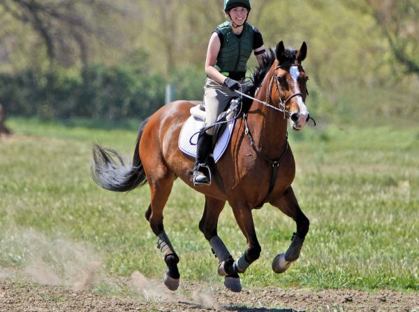
Main Photo: At rest stop for lunch in the Cypress Hills Interprovincial Park, Robbie munches grass in an area rich with history. The area was once part of the ancient Bearpaw Sea with dinosaurs and reptiles living along its shores. Long before European settlers came to the area, aboriginal groups called the Cypress Hills home. Credit: Tania Millen
Blogs & Podcasts

Advertisement

Related Articles


Advertisement
Featured Stories
Advertisement